I’ve been making trips to do fieldwork for RISE projects at Kilbourne Hole since the summer of 2017. My contribution has been to provide high resolution topography data to the team using stereophotogrammetry or structure from motion (SfM) methods. Although you can collected more direct measurements of the terrain using LiDAR, I use a methodology that utilizes camera images and differential GPS. The images can be collected from any camera, and the physical dimensions of the subject can be retrieved as long as the parameters of the cameras (positions and angles) meet the requirements for SfM.
What’s the subject in the images? Our primary target is the geology, but at what scale are we interested? What features? And what is the science question we want to answer once we have all of the geometric and morphometric data? The answer is different for every person who goes out to study Kilbourne Hole. The very smallest scale of observations is of interest, such as the grain size of ash particles from the eruptions that created Kilbourne Hole. For others, it’s the layers of ash or stratigraphy of the deposits. My most recent interest is the layers of lava that the eruptions blasted through and time has covered up by thousands of years of sedimentary deposition. Others care about the general large-scale similarity of the terrain to a lunar crater, making it a unique planetary analog for testing the procedures of exploration in an unfamiliar environment on another planet or the Moon. My attempts have been to provide data at all of these scales, but this has resulted in various levels of ‘meh’ and success.
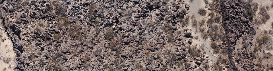
My most successful pursuit was the collection of image data from small unmanned aerial vehicles (sUAS) and the subsequent creation of digital elevation models (DEMs) and orthomosaics (simply geometrically well-constrained overhead imagery) at very high spatial resolution. My high resolution, I mean small cm-scale pixel size or ground sampling distance (GSD). In this case, every pixel is between 3 and 8 cm, depending on sUAS altitude. The large scale topography of Kilbourne Hole is already available from the USGS 3D Elevation Program, and it’s a great dataset with sub-meter detail available for large parts of the United States. When the RISE project started, we hadn’t yet discovered the 3DEP data or it might not yet have been available. So, our methodology was to pursue the use of sUAS and terrestrial LiDAR scanning (TLS) to provide the data. TLS is ‘bonkers’ high resolution, generally sub-cm resolution depending on the range distance. I can produce data of similar quality as TLS using SfM for limited areas, but certainly not at the speed, efficiency, and accuracy as TLS. The 3DEP LiDAR datasets are collected from an airplane, so the range from the target is substantially larger than TLS or SfM, and the efficiency and cost-effectiveness are fantastic. All of these datasets have exceptional advantages or qualities, but between the scales of 3DEP and ground-based TLS operations, sUAS fills a gap ideal for answering several science questions.
As I explain in my abstract for the upcoming presentation for the NASA Exploration Science Forum this summer, broader mapping was originally a goal in earlier stages of the RISE projects, but it was nearly phased out due to the large size of Kilbourne and the scope of the actual field activities was smaller. The utility of sUAS-derived data products was demonstrated during the 2023 RISE2 deployment, especially for derived map products for navigation and emerging science questions and themes, such as an analysis of block distribution and Afton basalt thickness. In the field, we realized not only was the entire circumference of Kilbourne Hole needed, but it was possible to obtain given a perfected sUAS concept of operations (CONOP). [You can tell where someone might work based on their use of acronyms.] One of the really cool things about the RISE projects has been meeting new people and graduate students, especially folks from the University of Texas El Paso. In this last field campaign in February 2024, my co-authors from UTEP and I “completed the circle,” acquiring high resolution sUAS imagery of the entire circumference of Kilbourne Hole.

The region of interest that sUAS data covers is specifically for key science questions we have about the margins of Kilbourne Hole. The middle is mainly fluvial and lacustrine deposits, and the other parts are thickly mantled lava flows. Stay tuned for more details and progress reports on this work.


You must be logged in to post a comment.