Tucson, AZ. I made a submission of kite aerial photographs to the Third Annual Art of Planetary Science exhibition at University of Arizona’s Lunar and Planetary Laboratory. Creative works of art inspired by the exploration of our Universe were featured next to works that would otherwise only be scientific data. It was a fantastic and unique juxtaposition, with over 200 submissions and over 100 artists.
I’ve been using kite aerial photography as a research tool to gather my own remote sensing data. I started this while I was a postdoc at the Smithsonian, and now, at LPL. I use the images to create three dimensional models and to make comparisons of landforms to other planetary surfaces, but I saw an opportunity to show these data as art. Out of tens of thousands of aerial images I’ve collected, I selected eight, and I had them printed on aluminum.
The Art of Planetary Science is an all-volunteer, public outreach effort run by graduate students at the Lunar and Planetary Laboratory. You can find out more online at www.lpl.arizona.edu/art and on Facebook (www.facebook.com/lpltaps). Enjoy my image submissions below.
Wind and Water at Great Sand Dunes, Colorado
-

- Great Sand Dunes National Park, Colorado
-

- Sand Creek, Colorado
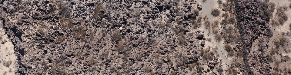
Lava Flow Surfaces, Reminiscent of Mars
-

- Hilina fault system, south flank of Kilauea, Hawaii
-

- Holuhraun, Iceland
Lava fields, El Malpais, New Mexico
-

- Inflation Pits, McCartys, NM
-

- Fractures, McCartys, NM
Planetary Particles (phi, 4 to -6)
-

- Bruneau Dunes, Idaho
-

- Askja, Iceland